The Kentish Coast
Share this page
The Kentish Coast (or should that by the Old Coast of Kent) is a surprisingly varied affair, combining dizzying chalk cliffs with golden sands and endless shingle beaches. I began at Broadstairs in the middle of Folk Week, but before nine in the morning there was little sign of it on the streets. The tidy arc of Viking Bay is a colourful pageant to the classic English seaside, with an old Punch and Judy stand as its centrepiece. I set off below the low dirty white cliffs – this part of the coast path is not yet open, but it is easy to trace a route round to Ramsgate along the cliffs. The town is reached by a set of stone stairs built into a fake section of cliff, exposed by the fact it is the colour of gritstone and not chalk. The chalk cliffs of the North Foreland continue until Pegwell Bay, where a Viking ship celebrates the first Saxon invasion here in 449. The crazy Danes who built the replica sailed it across the North Sea in 1949.
It is then a long slog along the road into Sandwich, reached via the old toll bridge and arched Barbican by the River Stour. It is a fine spot for lunch – a sandwich no less – before heading out onto the marshes. A sadist has designed the route here as it zigzags aimlessly along the embankments before eventually emerging by the low dunes of Sandwich Bay. There are golf courses, grandiose mansions and a lot of pebbles between here and Deal. This means it is impossible to walk on the beach for any distance, but does mean that a dip in the sea to wash off the day’s exertions is not accompanied by the need to extricate sand from everywhere. All the way past Deal the bright but murky turquoise English Channel surges up and down the pebbles, and to a northerner it has the colour and temperature (if not the clarity) of the Mediterranean. Fishing boats lie romantically upturned on the beach while revellers gather outside the pubs on the front for live bands. The bandstand at Walmer offers more laidback fare with a brass band playing Beatles covers in the sun, but I head inland to the Green Berry, one of the finest establishments I know.
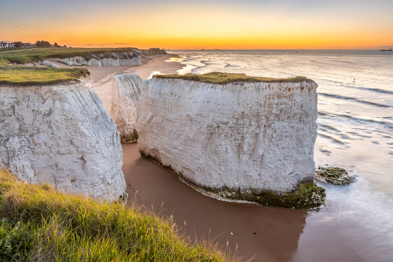
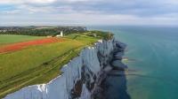
At Kingsdown, the pebbles seem to engulf the village, with the Zetland Arms perched precariously on the beach. White cliffs are rearing up ahead, those of the South Foreland, the iconic White Cliffs of Dover. Here they are vertical and brilliant white, not the grubby old bra colour of Ramsgate. I bound happily over the grassy clifftop leas to the Dover Patrol War Memorial and down into St Margaret’s Bay, the only place where you can gawp up at these dizzying cliffs. At the South Foreland lighthouse, you look out to France, where the chalk of Cap Blanc Nez shines brightly back. Here begins the proper White Cliffs of Dover and the cliffs are crawling with people on a sunny Sunday in August. They peer cautiously over the precipice and pose boldly on the edge, chattering in more languages than I can count. This is the first time I realise that this is just one of those places that everyone goes to in England – like Buckingham Palace and Stonehenge. It has taken me 38 years and, as impressive as the soaring cliffs are, I can’t wait to get beyond Dover to return to my solitary trek.
At Langdon Hole the main path curls inland, so I follow the more interesting and quieter clifftop line and find a remarkable path zigzagging down the near vertical edge. It is incised deeply into the rock and I reach the bottom to find a couple of other groups peering across a dozen feet of collapsed cliff at the old steps down onto the empty beach at Langdon Bay. The beach and the clifftop theme park above stand alongside the vast Eastern Docks, whose clamour dominates the air. I am surprised to find in Dover beyond, a fully functional town and even a busy sandy beach squeezed between the two docks. It is a town of fortified hills, the castle perched on one, the Drop Redoubt on another. The route climbs past these vast Napoleonic defences before rejoining the clifftops where a chalk knife edge climbs steadily away from the town. With the roar of the adjacent A20 and a line of wartime defences for company, the route to Folkestone is a surprising treat. Rounding a corner at the end of East Cliff, the whole of East Wear Bay is laid out below as the path tiptoes along a precarious clifftop path above the undercliffs of The Warren. It is still a long way into Folkestone past the first of many Martello Towers – small circular fortifications built during the Napoleonic Wars – along this coastline. The harbour smells pleasingly of fish and the town sprawls busily across the hills above.
At Folkestone there is a marked change in the character of the coast. As the North Downs march inland across Kent with their chalk, the shoreline flattens out to head out onto Romney Marsh. It is a wonderfully foreign view around the long sweep of the bay to Dungeness, an arc of golden sands ending abruptly at the nuclear power station in the far distance. It is actually some 20 miles of the most tedious walking, particularly under a hot sun. Apart from a lovely detour along the Royal Military Canal through Hythe, the route follows the concrete promenade all the way past Sandgate, Dymchurch, St Mary’s Bay and Littlestone-on-Sea. Hythe is an attractive town with a constant backdrop of rat-tat-tat from the adjacent MOD range. Dymchurch is hellish, branding itself as a kid’s paradise but little more than seaside tat and donkeys. By Greatstone-on-Sea the promenade has disappeared and the pebble beach abuts right on the seafront road. This and Lydd-on-Sea are rather sad looking linear settlements clinging to the edge of the marsh.
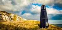
At the end of the front, a dead end road branches out to Dungeness, winding through an eerie landscape of pure pebbles. The houses here are wooden cabins perching uncertainly on the beach. There are no fences between properties, no gardens but for what remains of Derek Jarman’s famous driftwood garden at Prospect Cottage, where a group or two pile out of their vehicles for a photo opportunity. It is a decidedly un-British landscape with the sort of impermanence of settlements in the American west. At the end of the road, lighthouses new and old stand in the lee of the monstrous power station, another temporary box plonked on a shifting landscape. The coast path is barely defined here as it skirts around the perimeter fence and on across the great pebble bank towards the Lydd Ranges. I pass a family who have struggled across the pebbles on bikes but are bailing out as there is little sign of the coast path in this wasteland. In fact, it continues surprisingly past the lookout tower at the edge of the military range and picks up a track along the perimeter fence, but without being armed with a map it would be hard to assert this.
The desolate shingle landscape gives way to the endless marshes of Denge, Walland and Romney. The tower of Lydd Church – the Cathedral of the Marshes – beckons in the distance, but it is a long detour round the military ranges to rejoin the coast at Jury’s Gap. The sun has finally departed and true August weather set in by the time I join the seafront again. Wind howls across the deserted promenade and the angry sea smashes into the rocks of the coastal defences. My spirits are lifted by this reassertion of nature and the fact the holidaymakers have been sent fleeing from Camber’s endless sands. It is even too windy for kitesurfing so I am alone as I ghost past the dunes and shacks of Camber to reach the mouth of the River Rother. The rain arrives as I turn inland towards Rye, so I can barely glimpse the beautiful walled town perched on a low hill above the junction of the Brede and Rother as I cross the marsh towards it. Once a medieval seaside town and port itself, Rye is now stranded several miles inland, though I gather it does ok for itself. I bend my head and march through the downpour, then make a crazed run through the puddles for a passing bus that is kind enough to wait for me. Then back north, somewhere dry…